Longtime local journalist Bill Radford and his wife, Margaret, live on 5 acres in the Falcon area with chickens, rabbits, dogs, cats, a flock of parakeets, goats, two horses and two ducks. Contact Bill at billradford3@gmail.com.
Moisture from El Nino: the luck of the draw
By Bill Radford
Summer is officially over and the monsoon season is becoming just a memory.
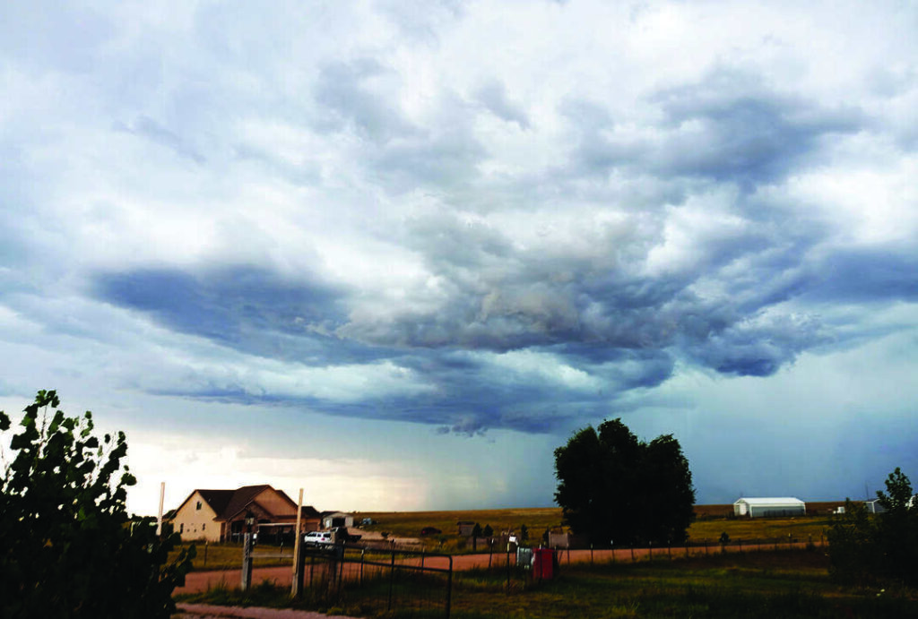
While autumn is off to a cool and soggy start, it was a hot and dry summer; I can remember maybe one good rain the entire summer. More often, it was a sprinkle or a tease by storm clouds that never delivered.
But not much of a memory. It was a hot and dry summer; I can remember maybe one good rain the entire summer. More often, it was a sprinkle or a tease by storm clouds that never delivered.
Though it was hot and dry all over, my wife and I have often wondered if Mother Nature has declared our neighborhood a no-rain zone. Certainly, we’ve had rain over the 14 years we have lived out here on the prairie. We’ve seen a river course through our pasture. Our ditches have filled with water and our dirt roads become mud pits. There was one glorious summer night years ago when a storm seemed to stay put just above us for an entire night, dumping more than 2 inches of rain.
But the more common scenarios is this: I’ll leave downtown Colorado Springs, where I work, and it’ll be raining. But the closer I get to home, the less it is raining, and when I do get home, there is no rain. And yet storms will later develop over the far Eastern Plains. Or we’ll get a sprinkle and then I’ll drive several miles north to say, Big R, where I find giant puddles reflecting a healthy rainfall.
So do we live in kind of a doughnut hole between the rain? Or is it just my imagination?
I posed that question to forecaster Matt Meister. You no doubt have seen him during his TV days and now he’s founder and chief meteorologist with Peaks2Plains Weather, which delivers “hyper-local forecasts” through an app, a website, social media and 24/7 on Roku, FireTV and YouTube.
“You’re not crazy!” he assured me in an email. And he also told me I was on the right track when I theorized our lack of rain had something to do with energy that develops over the mountains that fades by the time it reaches us but then builds back up farther east.
“There is built-in instability over the mountains nearly every day in the summer due to increased lapse rates, the rate at which air cools in the vertical, and a measure of stability,” he explained. “The ground at a given elevation over the mountains is hotter than the similar elevation over your head … so the rate of cooling in the vertical above the mountain surfaces is greater than over the plains. Sometimes storms will form in this instability and fall part before getting as far east as you.
“The Palmer Divide north of you is similar, but a little different. In cases of upslope, which we get at the surface about eight out of 10 summer late mornings through early evenings, the additional elevation to your north and the lift it provides can be enough to spark convection compared to your elevation.
“Storms moving over far eastern Colorado typically encounter deeper moisture and will either intensify as they hit this deeper moisture or develop along its western edge when the dryline is present.”
From our viewpoint in our little house on the prairie, we have a broad view of the western horizon, including downtown Colorado Springs and Fountain to the south. As we wait in vain for rain to reach us, we note with some envy that it seems like Fountain is always getting it. We’re not envious, though, that Fountain also seems to get battered by hail more often. So I also asked Meister: What’s up with that?
“Fountain can do well with storms when low-level moisture is surging up the Arkansas River Valley and it curls north up Fountain Creek,” he said. “Storms coming off Pikes Peak in northwest flow aloft can tap that moisture and strengthen. That’s what happened with the second large hailstorm in 2018 that impacted the southwest side of town including The Broadmoor and the zoo in addition to Fountain. That August setup threw a couple rounds of storms at Fountain on August 6th. That one dropped many 2.5-3 inch+ stones, including a 4-inch one near Widefield Community Park.
“The first storm that hit Fountain that year occurred in the middle of the night as very rich low-level moisture flew up the Arkansas River Valley in the middle of the night and slammed into the southeastern slopes of Pikes Peak in the early morning hours of June 13th. There were multiple reports of 3-inch hail with that one.”
And, finally, I asked Meister what impact, if any, would the prospect of a “super” El Niño have on us this winter.
“El Niño isn’t the only global driver of our weather in Colorado,” he said. “And a historically strong one puts you on alert a little bit in the sense that we need to be careful about comparing previous El Niño winters to what we might have in the upcoming winter season.
“That said, if you made me put money on the southern or northern mountains of Colorado having an above-average snow year, my money is down south. There is a stronger El Niño correlation compared to I-70 resorts, Winter Park and Steamboat.
“For areas east of the mountains, the likelihood of having a once or twice a decade type storm goes up during El Niño winters. Think Christmas blizzard of ’82, October ’97, the bomb cyclone in 2019 and the twin blizzards at the end of December in 2006 … those were all El Niño years.”
A blog post by Peter Gable on Colorado State University’s Colorado Climate Center website also notes that the Front Range and Eastern Plains are more prone to large spring snowstorms in an El Niño year. But as far as making up for last winter’s snowpack deficit, he had this to say: “The brewing super El Niño may offer some hope, but a wide array of outcomes are possible this winter. It is a bit like playing a game of poker with a few extra aces and kings in the deck. The deck may be stacked in our favor, but we could still draw a crummy hand.”