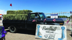
In 1993, after three years of research and debate, the citizen’s advisory committee, county planners, county commissioners and area representatives adopted the Falcon/Peyton Comprehensive Plan. The plan was intended as a guide for future development and land-use decisions, based on the advisory committee’s vision for Falcon and Peyton’s physical make-up and infrastructure.Fast-forward to 2004, and word has it that county decision-makers, including the county planners and commissioners, are ignoring the plan in favor of aimiless development. Carl Bebb was on the Falcon/Peyton Citizen’s Advisory Committee, and he said little has been done to adhere to the plan. “We made joint decisions – the citizens and the people who work for the county – on what we would like to see happen in the future, but no one is paying attention to those decisions,” Bebb said.Is the plan a means to an end or the government’s attempt to pacify residents of an unincorporated area?Carl Schueler, the El Paso County Planning Division manager, said the Colorado statute requires counties to adopt master plans for unincorporated territories. The planning commission (without approval of the county commissioners) adopts the plan, which is “advisory and not binding,” Schueler said. The commission can adopt the plan in part or in its entirety. “For the last 30 years, our approach in El Paso County has been to do the sub-area plans (like Falcon and Peyton) when we have the time and interest,” Schueler said. “It’s all held together by the El Paso County policy plan – an overall policy plan that says in its first chapter the small-area approach is the best one for this county.”The approach to gathering the small-area planning advisory committee is to first identify the planning area (a job designated to the county commissioners) and then, once the area is determined, citizens are asked to apply for inclusion on the committee. After the applications have come in, the board of county commissioners appoints the committee. The process is not without its drawbacks. “We can’t affored to send out postcards to everyone in the area to notify them about the application process,” Schueler said. “They basically find out by reading the newspapers.” Schueler said in the old days advisory committees consisted of property owners who were residents, but that has since changed to allow for non-resident property owners.Once the committee is intact, Schueler said the approach to the plan varies depending on circumstances. “We go to everything from a map approach to policies – the Falcon/Peyton plan was a compromise between the two – a concept document,” Schueler said.Although the plan itself is somewhat vague, what was clear is the committee’s resolve to protect the rural values indicative of the eastern plains. In section C, No. 1-b, the goal was to “guide growth in a manner which respects the existing rural character of the planning area while providing the greatest public benefit with the least negative impacts.” Ambiguous? Yes.However, according to the plan, the corridor along Highway 24 all the way north to Judge Orr Road, excluding the Falcon town site, is to be “maintained as primarily a rural residential neighborhood with a minimum of five-acre lot sizes. … Commercial and industrial development should be limited due to the residential nature of the area and to the current lack of central water and sewer. Strip development, along Highway 24 in particular, should not be allowed. Some light development or industrial development would be supported at Meadow Lake Airport as long as traffic safety and utility service concerns are addressed.”In other words, Schueler said the Big R Store and the Falcon Auto Center are two commerical developments that defied the plan. “In my opinion, there have been two major departures from the plan – developments approved but inconsistent with the plan,” Schueler said. “Big R and the Falcon Auto Center are two that got around the plan – the commissioners overroad the plan, and Falcon Heights is another. Falcon Heights was originally platted for five-acre plots, and it was approved for 2.5-acre plots. The commissioners overrode that plan. And if you look at the map, the Safeway area was not designated commercial.”The Woodmen Hills and Falcon Hills developments were approved prior to the plan, so both were grandfathered in, Schueler said. And the plan allowed for the logical extensions like Meridian Ranch and Bennett Ranch. Santa Fe Springs was also in place according to its 1989 original plan. Ray O’Sullivan bought the Santa Fe Springs development later and has modified it to shift densities to the west, adding more open space areas, but O’Sullivan also acquired an additional 800 acres. “The property owners who live directly across the proposed Santa Fe Springs development have the issues,” Schueler said.Regardless of the development plans, what are the rights of the property owners who bought after the fact and stand to lose their rural feel? The existing Santa Fe plan, which doesn’t include the density shift to the west, was a matter of public reocrd, but what real estate agent or buyer is going to chase down this information before the deal is sealed, said Schueler. “If Realtors know, they most likely will disclose the plans, but they don’t always know,” Schueler said. “If someone bought out there right now, there is nothing on record about the additional 800 acres that O’Sullivan purchased for the Santa Fe development.”There are some attempts to follow the comprehensive plan, but some decisions are clearly inconsistent with the black and white language, but the master plan is advisory in nature. Some of the individual decisions are consistent with the text and not the map.”How do the decisions get out of alignment with the master plan?Schueler said there are significant pre-existing situations. Developers came in and moved forward with their plans, and they were able to get central water and sewer systmes, but they needed more densities to create roads and attract a comercial base, so the residential building increased, Schueler said. “So we’ve now got this urban commerical center – doesn’t it make sense to extend it?” Schueler asked. “One decisions spawns another – the commercial area is expanded based on the density of residential. The Falcon town site is much bigger than originally planned; however, the county commissioners are pro-development. The plans are going to be approved unless they strongly go against the master plan.”What about plans for law enforcement, fire, water and utility issues?The plan also recommended a law enforcement substation in the immediate area, but that has not happened in line with the growth. “In a sense, you need incorporation to get those things, but the friction to get to that point is great,” Schueler said. “To incorporate, you need a tax base that is primarily non resiential, and then you need the districts to be in agreement and you need to determine funding and so on. Nothing stops until incorporation is done, and that is a tough road. We have not seen incorporation here for 100 years. Black Forest has tried off and on for 20 years, but the more rural the area, the harder it is. Do you want higher property taxes and added sales taxes?Water resources were listed as critical issues in the plan, which stated, “The majority of residents in the Falcon/Peyton planning area are dependent on individual wells for their water supply. Protection of both the quantity and quality of waters in the various aquifers underlying the planning area is therefore of critical importance.” The plan encourages central water systems for lots less than five acres, but it states “all new development proposals must adequately demonstrate that they will not have an adverse impact upon the quality and quantity of water available to existing and designated future rural residential areas.”The statement is not only vague but also debatable based on individual opinion. Schueler said developers must meet certain requirements to show adequate water supply. “However, there is still no surface water; water is definitely an issue,” Schueler said.The No. 1 rule in planning, Schueler said, is to follow the pattern. “And if there isn’t a great deal of objections, from neighbors, presumed development is a good thing,” Schueler said. “Debates are occurring on the edges. Where you’ve got rural and urban, you might have someone slightly extending the commercial area or filling in the land for a high-density development. The pattern is there, and no one is paying attention.”Part of the issue now with the Falcon/Peyton plan, said Schueler, is the citizens are worn out. There is not a requirement that the advisory committee must continue to follow processes after the plan’s adoption, but Schueler said the people who stay close to the plan give it more substance with the planners and commissioners. “If there is a constituency advocating for the plan, they tend to be the keepers of the plan, and there is more of a chance it will be followed,” Schueler said.Schueler said there is pressure to update the plan. There pressure is coming from those who want to continue to develop the area, Schueler said. “We have been trying to figure out how to get this plan updated, but there is no money to do so. However, we may look at using the fees charged for development applications to fund an updated plan.”Shueler said those monies could not be moved out of the general fund until 2005. Meanwhile, both new developers and eastern plans residents are interested in an update to the plan – it’s probably safe to say their reasons are different. A few of the plan recommendations
- Zoning
- Maintain rural feel
- Protect natural resources, including water
- Critical issues: water, transportation, services, land use
- Redesign problem intersections like U.S. Highway 24 and Meridian
- Preservation of the Rock Island railroad right-of-way
- Developers contributions to offset “off-site” impacts such as increased traffic volume and traffic safety
- Discussions to alleviate potential overcrowding of schools
- Law enforcement substation between Falcon and Peyton
- Adopt a vicious dog ordinance
- Keep Highway 24 a non-commercial corridor
- Discourage residential development in the vicinity of Meridian Road and Highway 24
- Discourage residential development contiguous to the Falcon town site
- The 1990 U.S. Census identified 1,233 dwelling units in the planning area
- The population was 3,227 in 1990
- Population density was 182 persons per square mile (the average in the county was 10 times higher)
- The median value of the home was 5,613
- The planning area was overwhelmingly Caucasian
- The median age was 29.8
- The median household income was $34,104
- The mean travel-to-work time was 29.4 minutes